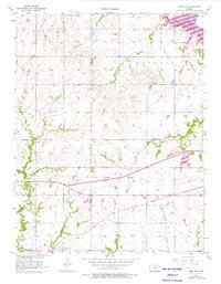
1957 Map of Lebo NW
USGS Topo · Published 1976About this map
Neosho Rapids sits at the southwestern corner of this Kansas landscape, where the Atchison Topeka and Santa Fe railroad cuts across the prairie. This 1957 survey, updated with 1973 revisions, reveals a complex intersection of historic boundaries and water management. The Old Indian Boundary bisects the terrain diagonally, a physical reminder of 19th-century land divisions that predates the modern county lines of Lyon, Osage, and Coffey. To the northeast, the Melvern Lake reservoir occupies the valley of the Marais des Cygnes River, illustrating the mid-century transformation of the local watershed.
Find a feature on this map
26 named features on this map. Tap any name to fly to it.
Don’t see what you’re looking for? This feature index may not catch every label — zoom into the map to look around manually.
Map Details
Editions of this 1957 Lebo NW Map
3 editions found
Other maps of this area

1885 · Eskridge
USGS Topo · 1:125,000

1885 · Burlington
USGS Topo · 1:125,000

1888 · Emporia
USGS Topo · 1:125,000

1889 · Burlingame
USGS Topo · 1:125,000

1889 · Eskridge
USGS Topo · 1:125,000

1894 · Emporia
USGS Topo · 1:125,000

1894 · Eskridge
USGS Topo · 1:125,000

1894 · Burlingame
USGS Topo · 1:125,000

1894 · Burlington
USGS Topo · 1:125,000

1947 · Lawrence
USGS Topo · 1:250,000