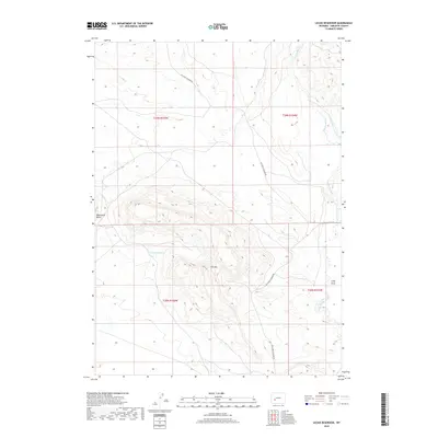
2018 Map of Leckie Reservoir
USGS Topo · Published 2018About this map
Leckie Reservoir sits at the center of this high-desert landscape in Sublette County, where the terrain is defined by prominent landmarks like Tabernacle Butte and Elk Mtn. This 2018 survey documents a region dominated by wide-open spaces and the essential water routes that shaped its history, such as Little Sandy Cr and the drainage of Long Draw. The map illustrates a network of functional transportation routes, including Big Sandy Elkhorn Rd and Elkhorn-Cutoff Rd, which cut through the public and private lands of the Sagebrush Steppe. These roads reflect the long-standing use of the area for ranching and resource management, connecting the various townships and ranges that divide this portion of Wyoming's western interior.
Find a feature on this map
11 named features on this map. Tap any name to fly to it.
Don’t see what you’re looking for? This feature index may not catch every label — zoom into the map to look around manually.
Map Details
Editions of this 2018 Leckie Reservoir Map
This is the sole edition of this map. No revisions or reprints were ever made.
Other maps of this area

1955 · Lander
USGS Topo · 1:250,000

1958 · Lander
USGS Topo · 1:250,000

1958 · Parting of the Ways
USGS Topo · 1:62,500

1958 · Parting of the Ways
USGS Topo · 1:24,000

1961 · Lander
USGS Topo · 1:250,000

1969 · Leckie Reservoir
USGS Topo · 1:24,000

1969 · Leckie SW
USGS Topo · 1:24,000

1969 · Jensen Meadows
USGS Topo · 1:24,000

1969 · Tabernacle Butte
USGS Topo · 1:24,000
1969 · Big Sandy Reservoir SE
USGS Topo · 1:24,000