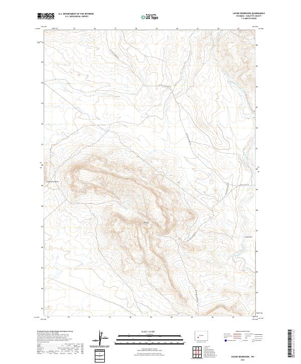
2021 Map of Leckie Reservoir
USGS Topo · Published 2021About this map
Tabernacle Butte and Elk Mtn dominate the high-elevation terrain of this Sublette County landscape, where the high desert meets the foothills. The area is defined by its sparse but critical water management features, notably the Elkhorn Ditch and the winding course of Little Sandy Cr through the eastern sections. The road network, including the Big Sandy Elkhorn Rd and Elkhorn-Cutoff Rd, follows the natural contours of the land, connecting remote grazing territories and providing access to geographical landmarks like Long Draw. This 2021 study reflects the persistent nature of Wyoming's open range, where land use is dictated by the availability of water and the rugged topography of the Green River Basin's eastern edge.
Find a feature on this map
11 named features on this map. Tap any name to fly to it.
Don’t see what you’re looking for? This feature index may not catch every label — zoom into the map to look around manually.
Map Details
Editions of this 2021 Leckie Reservoir Map
This is the sole edition of this map. No revisions or reprints were ever made.
Other maps of this area

1955 · Lander
USGS Topo · 1:250,000

1958 · Lander
USGS Topo · 1:250,000

1958 · Parting of the Ways
USGS Topo · 1:62,500

1958 · Parting of the Ways
USGS Topo · 1:24,000

1961 · Lander
USGS Topo · 1:250,000

1969 · Leckie Reservoir
USGS Topo · 1:24,000

1969 · Leckie SW
USGS Topo · 1:24,000

1969 · Jensen Meadows
USGS Topo · 1:24,000

1969 · Tabernacle Butte
USGS Topo · 1:24,000
1969 · Big Sandy Reservoir SE
USGS Topo · 1:24,000