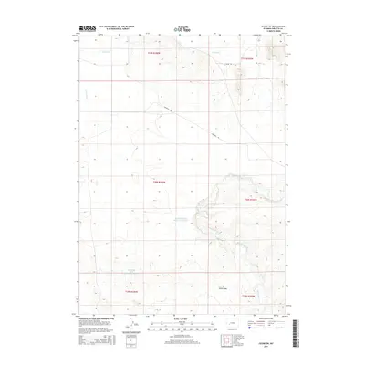
2015 Map of Leckie SW
USGS Topo · Published 2015About this map
Emigrant Trl cuts across this high desert landscape, marking the enduring path of historic westward movement through Sublette County. The terrain is defined by the winding course of the Big Sandy River, which creates a distinct riparian corridor against the surrounding arid lands. Human intervention in the hydrology is visible through the Sandy Big Bend Reservoir Number 1, which harnesses the river's flow near the large meander for which it is named.
Find a feature on this map
13 named features on this map. Tap any name to fly to it.
Don’t see what you’re looking for? This feature index may not catch every label — zoom into the map to look around manually.
Map Details
Editions of this 2015 Leckie SW Map
This is the sole edition of this map. No revisions or reprints were ever made.
Other maps of this area

1955 · Lander
USGS Topo · 1:250,000

1958 · Lander
USGS Topo · 1:250,000

1961 · Lander
USGS Topo · 1:250,000

1964 · Fremont Butte
USGS Topo · 1:24,000
1964 · Square Top
USGS Topo · 1:24,000

1969 · Pocket Creek Lake
USGS Topo · 1:24,000

1969 · Leckie Reservoir
USGS Topo · 1:24,000

1969 · Leckie SW
USGS Topo · 1:24,000
1969 · Bull Draw
USGS Topo · 1:24,000

1969 · Tabernacle Butte
USGS Topo · 1:24,000