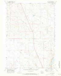
1969 Map of Bull Draw
USGS Topo · Published 1973About this map
The Big Sandy River cuts through the southeastern corner of this high-desert landscape in Sublette County, marking a vital water source in an area dominated by seasonal drainage systems. The terrain is defined by a series of long, erosional features including Bull Draw, Long Draw, and Mud Hole Draw, which illustrate the complex watershed management of this Wyoming rangeland during the late 1960s. Human infrastructure is sparse but intentional, centered on water retention and communication, such as the Mud Hole Reservoir and a lone Radio Tower situated near the center of the sheet. A small Gravel Pit near the northern boundary and scattered water sources like Water Hole Draw and a secluded Spring highlight the area's utility for livestock and local road maintenance. This survey captures a moment when the wide-open spaces of the West were precisely mapped to track the fundamental resources of water and topography.
Find a feature on this map
10 named features on this map. Tap any name to fly to it.
Don’t see what you’re looking for? This feature index may not catch every label — zoom into the map to look around manually.
Map Details
Editions of this 1969 Bull Draw Map
2 editions found
Other maps of this area

1955 · Lander
USGS Topo · 1:250,000

1958 · Lander
USGS Topo · 1:250,000

1961 · Lander
USGS Topo · 1:250,000
1964 · Square Top
USGS Topo · 1:24,000
1969 · Juel Spring
USGS Topo · 1:24,000
1969 · Teakettle Butte
USGS Topo · 1:24,000

1969 · Leckie SW
USGS Topo · 1:24,000

1969 · Tabernacle Butte
USGS Topo · 1:24,000
1969 · Big Sandy Reservoir
USGS Topo · 1:24,000
1969 · Stud Horse Butte
USGS Topo · 1:24,000