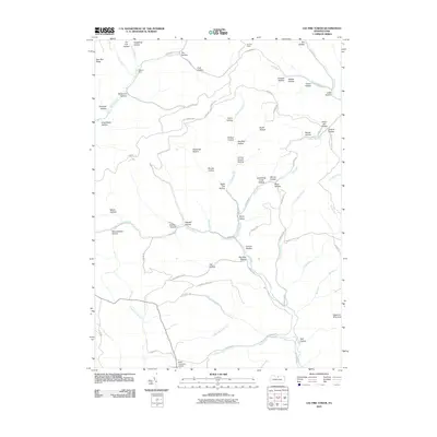
2010 Map of Lee Fire Tower
USGS Topo · Published 2010About this map
The Lee Fire Tower overlooks a landscape defined by deep drainages and named hollows in this 2010 survey of Potter County. The terrain is marked by an intricate network of waterways including Kettle Creek, Francis Branch, and Manor Fork, which have carved out distinct geographical features like Stony Valley and Carson Hollow. The naming conventions found here, such as Tinsmith Hollow, King Smith Hollow, and Indian Bill Hollow, suggest a history of early homesteading and specific trades.
Find a feature on this map
80 named features on this map. Tap any name to fly to it.
Don’t see what you’re looking for? This feature index may not catch every label — zoom into the map to look around manually.
Map Details
Editions of this 2010 Lee Fire Tower Map
This is the sole edition of this map. No revisions or reprints were ever made.
Other maps of this area

1937 · Waterville
USGS Topo · 1:48,000

1943 · Hyner
USGS Topo · 1:62,500

1943 · Waterville
USGS Topo · 1:62,500

1946 · Young Womans Creek
USGS Topo · 1:24,000

1946 · Tiadaghton
USGS Topo · 1:24,000

1946 · Antrim
USGS Topo · 1:62,500

1946 · Renovo East
USGS Topo · 1:62,500

1946 · Cedar Run
USGS Topo · 1:24,000

1946 · Slate Run
USGS Topo · 1:24,000

1947 · Galeton
USGS Topo · 1:62,500