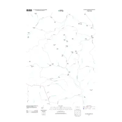
2013 Map of Lee Fire Tower
USGS Topo · Published 2013About this map
Lee Fire Tower overlooks a landscape defined by deep drainages and narrow ridges in this 2013 study of the Abbott Township area. The terrain is characterized by a dense network of named hollows, such as Schoolhouse Hollow, Wildcat Hollow, and Indian Bill Hollow, which reflect a legacy of local nomenclature tied to the region's topography. The southern portion of the map includes a section of the Algerine Wild Area, indicating a shift toward conservation and the preservation of the forest's natural character.
Find a feature on this map
84 named features on this map. Tap any name to fly to it.
Don’t see what you’re looking for? This feature index may not catch every label — zoom into the map to look around manually.
Map Details
Editions of this 2013 Lee Fire Tower Map
This is the sole edition of this map. No revisions or reprints were ever made.
Other maps of this area

1937 · Waterville
USGS Topo · 1:48,000

1943 · Hyner
USGS Topo · 1:62,500

1943 · Waterville
USGS Topo · 1:62,500

1946 · Young Womans Creek
USGS Topo · 1:24,000

1946 · Tiadaghton
USGS Topo · 1:24,000

1946 · Antrim
USGS Topo · 1:62,500

1946 · Renovo East
USGS Topo · 1:62,500

1946 · Cedar Run
USGS Topo · 1:24,000

1946 · Slate Run
USGS Topo · 1:24,000

1947 · Galeton
USGS Topo · 1:62,500