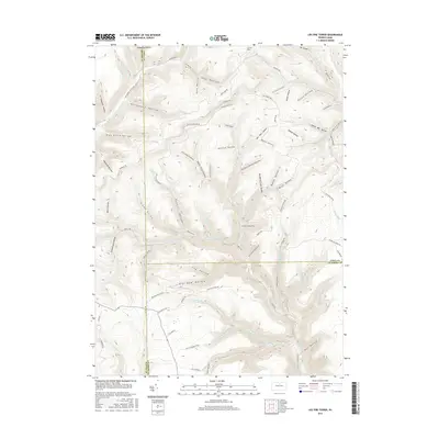
2016 Map of Lee Fire Tower
USGS Topo · Published 2016About this map
Lee Fire Tower stands as the primary landmark in this densely dissected landscape at the meeting point of Potter, Tioga, and Lycoming Counties. The drainage pattern is exceptionally detailed, defined by the winding course of Kettle Creek and its many tributaries, including Cherry Run, Slidery Br, and the Francis Branch. The map reveals a complex network of narrow valleys and ridges, with family-named or descriptive landmarks such as Hedgehog Hollow, Tinsmith Hollow, and Schoolhouse Hollow providing a glimpse into the naming traditions of the area's early inhabitants. Human activity is represented by timber and resource-related infrastructure, seen in the winding Francis Leetonia Rd, the Pipeline Rd, and Clay Mine Rd. The terrain transitions from high plateaus like Chestnut Ridge Rd down into deep incisions like Stony Valley and Jug Hollow, illustrating the typical topography of the Pennsylvania Wilds region.
Find a feature on this map
85 named features on this map. Tap any name to fly to it.
Don’t see what you’re looking for? This feature index may not catch every label — zoom into the map to look around manually.
Map Details
Editions of this 2016 Lee Fire Tower Map
This is the sole edition of this map. No revisions or reprints were ever made.
Other maps of this area

1937 · Waterville
USGS Topo · 1:48,000

1943 · Hyner
USGS Topo · 1:62,500

1943 · Waterville
USGS Topo · 1:62,500

1946 · Young Womans Creek
USGS Topo · 1:24,000

1946 · Tiadaghton
USGS Topo · 1:24,000

1946 · Antrim
USGS Topo · 1:62,500

1946 · Renovo East
USGS Topo · 1:62,500

1946 · Cedar Run
USGS Topo · 1:24,000

1946 · Slate Run
USGS Topo · 1:24,000

1947 · Galeton
USGS Topo · 1:62,500