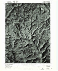
1977 Map of Lee Fire Tower
USGS Topo · Published 1979About this map
Lee Fire Tower overlooks a landscape defined by sharp drainage divides and deeply incised valleys in this orthophotomap of north-central Pennsylvania. Captured via aerial photography in 1977, the sheet highlights the intricate network of watercourses including Cushman Branch, Francis Branch, and Slate, which carve through the dense upland forests. The absence of roads or clearings across much of this terrain emphasizes the remote, undisturbed character of the area during the late 1970s. This imagery offers a precise look at the forest canopy and hydrological patterns before modern land use changes, providing researchers a clear view of the natural topography in Tioga County.
Find a feature on this map
4 named features on this map. Tap any name to fly to it.
Don’t see what you’re looking for? This feature index may not catch every label — zoom into the map to look around manually.
Map Details
Editions of this 1977 Lee Fire Tower Map
This is the sole edition of this map. No revisions or reprints were ever made.
Other maps of this area

1937 · Waterville
USGS Topo · 1:48,000

1943 · Hyner
USGS Topo · 1:62,500

1943 · Waterville
USGS Topo · 1:62,500

1946 · Young Womans Creek
USGS Topo · 1:24,000

1946 · Tiadaghton
USGS Topo · 1:24,000

1946 · Antrim
USGS Topo · 1:62,500

1946 · Renovo East
USGS Topo · 1:62,500

1946 · Cedar Run
USGS Topo · 1:24,000

1946 · Slate Run
USGS Topo · 1:24,000

1947 · Galeton
USGS Topo · 1:62,500