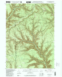
1994 Map of Lee Fire Tower
USGS Topo · Published 1999About this map
Lee Fire Tower overlooks the meeting point of three major Pennsylvania state forests, marking a landscape defined by deep ravines and timber management. The terrain is divided by the borders of Potter, Tioga, and Lycoming counties, with drainage networks including Kettle Creek and Cedar Run carving through the plateau. This 1994 update reveals a landscape used for both resource extraction and recreation, featuring a Clay Mine near the Lycoming county line and a remote Landing Strip in the south. The mapping of the Tiadaghton State Forest, Susquehannock State Forest, and Tioga State Forest shows a massive contiguous protected area interlaced with forest roads like Sliders Road and historical corridors such as the Pipeline Road. These trails and roads, including the Cushman Trail and Fill Trestle Trail, follow the natural contours of ridges like Buck Ridge and the winding paths of numerous runs and hollows.
Find a feature on this map
57 named features on this map. Tap any name to fly to it.
Don’t see what you’re looking for? This feature index may not catch every label — zoom into the map to look around manually.
Map Details
Editions of this 1994 Lee Fire Tower Map
This is the sole edition of this map. No revisions or reprints were ever made.
Other maps of this area

1937 · Waterville
USGS Topo · 1:48,000

1943 · Hyner
USGS Topo · 1:62,500

1943 · Waterville
USGS Topo · 1:62,500

1946 · Young Womans Creek
USGS Topo · 1:24,000

1946 · Tiadaghton
USGS Topo · 1:24,000

1946 · Antrim
USGS Topo · 1:62,500

1946 · Renovo East
USGS Topo · 1:62,500

1946 · Cedar Run
USGS Topo · 1:24,000

1946 · Slate Run
USGS Topo · 1:24,000

1947 · Galeton
USGS Topo · 1:62,500