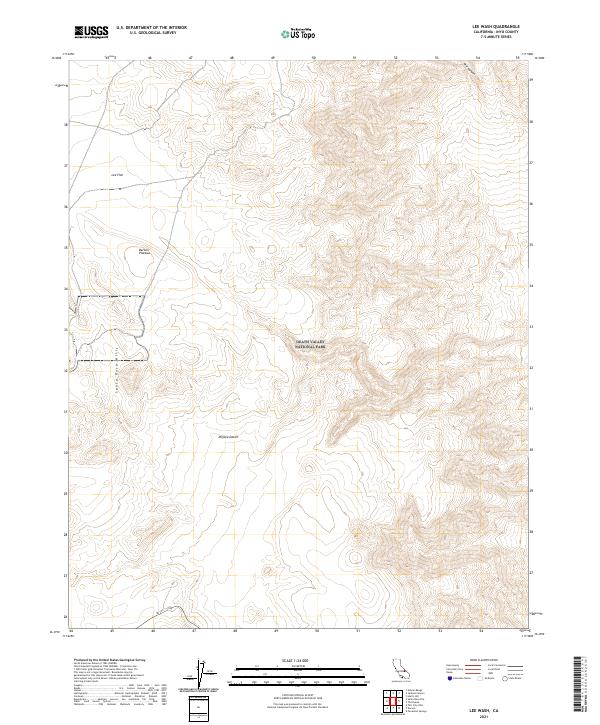
2021 Map of Lee Wash
USGS Topo · Published 2021About this map
Death Valley National Park dominates the central topography of this landscape, where the high arid elevations of the Santa Rosa Hills meet the northern reaches of the Mojave Desert. This 2021 survey illustrates a transition from the broad, open expanses of Lee Flat and the Darwin Plateau in the northwest to the complex drainage systems and steep contours of Mill Canyon in the northeast. The only primary transportation artery shown is SR 190, which skirts the southern boundary, providing access to these isolated sections of Inyo County. The map is defined by its dramatic elevation changes and lack of permanent settlements, reflecting the austere character of the high desert environment and protected federal lands.
Find a feature on this map
13 named features on this map. Tap any name to fly to it.
Don’t see what you’re looking for? This feature index may not catch every label — zoom into the map to look around manually.
Map Details
Editions of this 2021 Lee Wash Map
This is the sole edition of this map. No revisions or reprints were ever made.
Other maps of this area

1908 · Ballarat
USGS Topo · 1:250,000

1913 · Ballarat
USGS Topo · 1:250,000

1948 · Death Valley
USGS Topo · 1:250,000

1950 · Darwin
USGS Topo · 1:62,500

1950 · Ubehebe Peak
USGS Topo · 1:62,500

1951 · Darwin
USGS Topo · 1:62,500

1951 · Ubehebe Peak
USGS Topo · 1:62,500

1951 · Panamint Butte
USGS Topo · 1:62,500

1951 · Marble Canyon
USGS Topo · 1:62,500

1954 · Death Valley
USGS Topo · 1:250,000