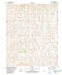
1987 Map of Leedey SW
USGS Topo · Published 1987About this map
Angora and the surrounding high plains of Western Oklahoma are depicted here in the late 1980s, showcasing a landscape defined by an extensive energy extraction network. The terrain is marked by numerous Gas Wells and an Oil Well, with several pipelines cutting across the county lines that divide Roger Mills, Dewey, and Custer counties. The rural character of the area is anchored by local landmarks such as Red Star Ch and the Dewey Cem, reflecting the enduring community nodes in this sparsely populated region.
Find a feature on this map
13 named features on this map. Tap any name to fly to it.
Don’t see what you’re looking for? This feature index may not catch every label — zoom into the map to look around manually.
Map Details
Editions of this 1987 Leedey SW Map
This is the sole edition of this map. No revisions or reprints were ever made.
Other maps of this area

1955 · Clinton
USGS Topo · 1:250,000

1957 · Clinton
USGS Topo · 1:250,000

1960 · Cheyenne
USGS Topo · 1:62,500

1960 · Hammon
USGS Topo · 1:62,500

1961 · Leedey
USGS Topo · 1:62,500

1965 · Roll NE
USGS Topo · 1:24,000

1966 · Roll SE
USGS Topo · 1:24,000

1984 · Foss Reservoir
USGS Topo · 1:100,000
1987 · Flying Creek
USGS Topo · 1:24,000
1987 · Leedey
USGS Topo · 1:24,000