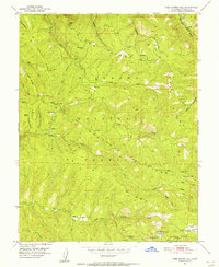
1951 Map of Leek Spring Hill
USGS Topo · Published 1956About this map
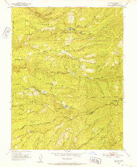
Eldorado National Forest dominates this mid-century topographic study, revealing a high-altitude landscape defined by the drainage systems of two major river basins. The northern reach is carved by the Silver Fork American River and its steep tributaries like Screech Owl Canyon, while the southern portion is shaped by the headwaters of the North Fork Cosumnes River and its middle and south forks. This area was primarily a site of resource management and fire surveillance, anchored by the Lookout at Leek Spring Hill. Scattered settlements and named points like Pilliken, Morrison, and the curiously named Buckskin Joe Spring suggest a history of seasonal camps and forest service outposts. The prominent Plummer Ridge and Baltic Ridge provide the primary geographic framework, separating the various creek systems including Mill Creek and Alder Creek.
Find a feature on this map
40 named features on this map. Tap any name to fly to it.
Don’t see what you’re looking for? This feature index may not catch every label — zoom into the map to look around manually.
Map Details
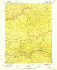
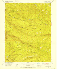
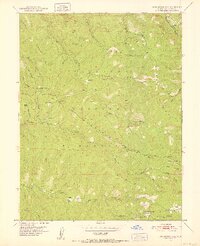
Editions of this 1951 Leek Spring Hill Map
3 editions found

Other maps of this area

1889 · Pyramid Peak
USGS Topo · 1:125,000

1891 · Pyramid Peak
USGS Topo · 1:125,000

1895 · Pyramid Peak
USGS Topo · 1:125,000

1896 · Pyramid Peak
USGS Topo · 1:125,000

1947 · Sacramento
USGS Topo · 1:250,000

1948 · Sacramento
USGS Topo · 1:250,000
1950 · Riverton
USGS Topo · 1:24,000
1951 · Stump Spring
USGS Topo · 1:24,000
1951 · Leek Spring Hill
USGS Topo · 1:24,000
1951 · Caldor
USGS Topo · 1:24,000