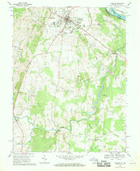
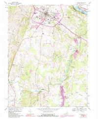
1968 Map of Leesburg
USGS Topo · Published 1970About this map
Leesburg serves as the hub of this Northern Virginia landscape, showing the town's footprint before the significant suburban expansion of the late 20th century. The map details a community defined by its educational and civic institutions, including the Douglass High Sch, Catoctin Sch, and the National Childrens Rehabilitation Center. To the south, the terrain transitions into agricultural and industrial history at Oatlands and Evergreen Mills, where the waters of Goose Creek and the Little River converge.
Find a feature on this map
51 named features on this map. Tap any name to fly to it.
Don’t see what you’re looking for? This feature index may not catch every label — zoom into the map to look around manually.
Map Details
Editions of this 1968 Leesburg Map
5 editions found
Other maps of this area

1884 · Harpers Ferry
USGS Topo · 1:125,000

1890 · Mt. Vernon
USGS Topo · 1:125,000

1891 · Harpers Ferry
USGS Topo · 1:125,000

1891 · Mt. Vernon
USGS Topo · 1:125,000

1893 · Frederick
USGS Topo · 1:125,000

1893 · Harpers Ferry
USGS Topo · 1:125,000

1894 · Warrenton
USGS Topo · 1:125,000

1894 · Frederick
USGS Topo · 1:125,000

1894 · Mt. Vernon
USGS Topo · 1:125,000

1897 · Mt. Vernon
USGS Topo · 1:125,000