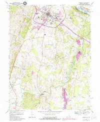
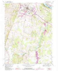
1968 Map of Leesburg
USGS Topo · Published 1988About this map
Leesburg serves as the focal point of this Loudoun County landscape, showing the town's expansion toward Tuscarora Creek and the establishment of the Leesburg Municipal Airport Godfrey Field. The map records a transition in the rural areas, where historic crossroads like Gleedsville, Oatlands, and Evergreen Mills maintain their character alongside emerging suburban developments. To the north, the Potomac River forms the state boundary with Montgomery Co, Maryland, featuring the protected corridor of the Chesapeake and Ohio Canal National Historical Park and Harrison Island. The southern reaches are defined by the winding course of Goose Creek and the infrastructure of the Beaverdam Creek Reservoir. Local history is anchored by community landmarks such as Douglas High Sch, Mt Olive Ch, and the Union Cem, while the western edge is dominated by the steep rise of Hogback Mountain at Mountain Gap.
Find a feature on this map
58 named features on this map. Tap any name to fly to it.
Don’t see what you’re looking for? This feature index may not catch every label — zoom into the map to look around manually.
Map Details
Editions of this 1968 Leesburg Map
5 editions found
Other maps of this area

1884 · Harpers Ferry
USGS Topo · 1:125,000

1890 · Mt. Vernon
USGS Topo · 1:125,000

1891 · Harpers Ferry
USGS Topo · 1:125,000

1891 · Mt. Vernon
USGS Topo · 1:125,000

1893 · Frederick
USGS Topo · 1:125,000

1893 · Harpers Ferry
USGS Topo · 1:125,000

1894 · Warrenton
USGS Topo · 1:125,000

1894 · Frederick
USGS Topo · 1:125,000

1894 · Mt. Vernon
USGS Topo · 1:125,000

1897 · Mt. Vernon
USGS Topo · 1:125,000