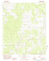
1982 Map of Leesburg
USGS Topo · Published 1983About this map
Pisgah and its local institutions, including the Pisgah High Sch and the Pisgah Cem, anchor the northwestern corner of this Rankin County landscape. The topography is defined by the drainage basins of Fannegusha Creek and Rollison Creek, which flank the elevated Rollison Prairie at the center of the sheet. This area reflects a traditional rural settlement pattern where life was organized around crossroads and community churches, such as Oak Grove Ch and Rehoboth Ch.
Find a feature on this map
31 named features on this map. Tap any name to fly to it.
Don’t see what you’re looking for? This feature index may not catch every label — zoom into the map to look around manually.
Map Details
Editions of this 1982 Leesburg Map
This is the sole edition of this map. No revisions or reprints were ever made.
Other maps of this area

1922 · Morton
USGS Topo · 1:48,000

1922 · Pelahatchee
USGS Topo · 1:48,000

1924 · Pelahatchee
USGS Topo · 1:62,500

1924 · Morton
USGS Topo · 1:62,500

1950 · Pelahatchie
USGS Topo · 1:62,500

1951 · Morton
USGS Topo · 1:62,500

1952 · Pelahatchie
USGS Topo · 1:62,500

1953 · Meridian
USGS Topo · 1:250,000

1957 · Meridian
USGS Topo · 1:250,000

1960 · Sharon
USGS Topo · 1:62,500