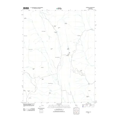
2012 Map of Leesville
USGS Topo · Published 2012About this map
Leesville sits at the junction of several historic mountain routes, serving as a focal point for this section of Colusa County. The landscape is defined by its series of distinct valleys and flats, including Sawtelle Valley, Shoemaker Valley, and Oat Valley, which suggest a long history of ranching and transit through the Coast Ranges. Water sources are vital markers on this terrain, with Adobe Spring, Skinnerville Spring, and Sulphur Spring scattered across the map, often located near the base of prominent landmarks like the Bear Valley Buttes. The placement of Robbers Flat near the rugged Stinchfield Canyon hints at the area's colorful local lore. Movement through the region is dictated by the gaps and passes, most notably Leesville Gap, which connects the high valley floor to the winding paths of Bartlett Springs Rd and Bear Valley Rd.
Find a feature on this map
48 named features on this map. Tap any name to fly to it.
Don’t see what you’re looking for? This feature index may not catch every label — zoom into the map to look around manually.
Map Details
Editions of this 2012 Leesville Map
This is the sole edition of this map. No revisions or reprints were ever made.
Other maps of this area

1904 · Sites
USGS Topo · 1:24,000

1905 · Fairview
USGS Topo · 1:24,000

1917 · Sites
USGS Topo · 1:31,680

1920 · Venado
USGS Topo · 1:62,500

1924 · Bartlett Springs
USGS Topo · 1:62,500

1942 · Bartlett Springs
USGS Topo · 1:62,500

1943 · Lodoga
USGS Topo · 1:62,500

1944 · Bartlett Springs
USGS Topo · 1:62,500

1944 · Wilbur Springs
USGS Topo · 1:62,500

1951 · Stonyford
USGS Topo · 1:62,500