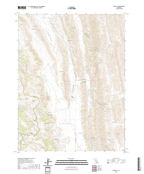
2022 Map of Leesville
USGS Topo · Published 2022About this map
Leesville sits at the junction of several historic mountain routes, serving as a primary point of reference in this pocket of the California Coast Range where Colusa and Lake Counties meet. The landscape is defined by long, north-south valleys including Bear Valley, Indian Valley, and Shoemaker Valley, separated by steep ridges and notable peaks like Gravelly Buttes and Lambert Hill. This 2022 survey documents the complex network of backcountry roads such as the Leesville-Lodoga Rd and Old Leesville Grade, which follow the natural contours of the terrain through gaps like Leesville Gap. Local history is anchored by features such as the Leesville Cem and distinct flats like Robbers Flat and Gravelly Flat. Numerous water sources, including Sulphur Spring, Adobe Spring, and Barrel Spring, dot the canyons, highlighting the essential water sites that historically dictated travel and ranching patterns in this arid, high-elevation environment.
Find a feature on this map
62 named features on this map. Tap any name to fly to it.
Don’t see what you’re looking for? This feature index may not catch every label — zoom into the map to look around manually.
Map Details
Editions of this 2022 Leesville Map
This is the sole edition of this map. No revisions or reprints were ever made.
Other maps of this area

1904 · Sites
USGS Topo · 1:24,000

1905 · Fairview
USGS Topo · 1:24,000

1917 · Sites
USGS Topo · 1:31,680

1920 · Venado
USGS Topo · 1:62,500

1924 · Bartlett Springs
USGS Topo · 1:62,500

1942 · Bartlett Springs
USGS Topo · 1:62,500

1943 · Lodoga
USGS Topo · 1:62,500

1944 · Bartlett Springs
USGS Topo · 1:62,500

1944 · Wilbur Springs
USGS Topo · 1:62,500

1951 · Stonyford
USGS Topo · 1:62,500