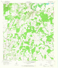
1962 Map of Leesville
USGS Topo · Published 1966About this map
Sandies Creek and its many tributaries, including O'Neal Creek and Salt Creek, define the drainage of this central Texas landscape in the early 1960s. The settlement at Leesville serves as a local hub, while the small community of Bebe anchors the eastern edge of the survey. The terrain is marked by a network of family-named cemeteries that provide a record of rural kinship and early settlement, such as Ellis-Nance Cem, Stromar Cem, and Askey Cem.
Find a feature on this map
25 named features on this map. Tap any name to fly to it.
Don’t see what you’re looking for? This feature index may not catch every label — zoom into the map to look around manually.
Map Details
Editions of this 1962 Leesville Map
2 editions found
Other maps of this area

1911 · San Marcos
USGS Topo · 1:125,000

1919 · San Marcos
USGS Topo · 1:125,000

1920 · Smiley
USGS Topo · 1:125,000

1924 · San Marcos 3-d
USGS Topo · 1:48,000

1925 · San Marcos 4-c
USGS Topo · 1:48,000

1929 · Luling
USGS Topo · 1:62,500

1930 · Seguin
USGS Topo · 1:62,500

1942 · Dewville
USGS Topo · 1:62,500

1953 · Seguin
USGS Topo · 1:250,000

1956 · Dewville
USGS Topo · 1:62,500