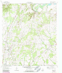
1962 Map of Leesville
USGS Topo · Published 1987About this map
The Guadalupe River and Lake Gonzales dominate the northern landscape of this Texas survey, where the river's winding path gives way to a network of creek branches like Burroughs Creek and Sugar Creek. Further south, the community of Leesville sits near the confluence of Sandies Creek and Salt Creek, while Bebe serves as a small crossroad settlement to the east. This 1962 topography, updated with later photo-revisions, reveals a dispersed rural pattern of small family cemeteries and country churches typical of the region's agricultural history.
Find a feature on this map
27 named features on this map. Tap any name to fly to it.
Don’t see what you’re looking for? This feature index may not catch every label — zoom into the map to look around manually.
Map Details
Editions of this 1962 Leesville Map
2 editions found
Other maps of this area

1911 · San Marcos
USGS Topo · 1:125,000

1919 · San Marcos
USGS Topo · 1:125,000

1920 · Smiley
USGS Topo · 1:125,000

1924 · San Marcos 3-d
USGS Topo · 1:48,000

1925 · San Marcos 4-c
USGS Topo · 1:48,000

1929 · Luling
USGS Topo · 1:62,500

1930 · Seguin
USGS Topo · 1:62,500

1942 · Dewville
USGS Topo · 1:62,500

1953 · Seguin
USGS Topo · 1:250,000

1956 · Dewville
USGS Topo · 1:62,500