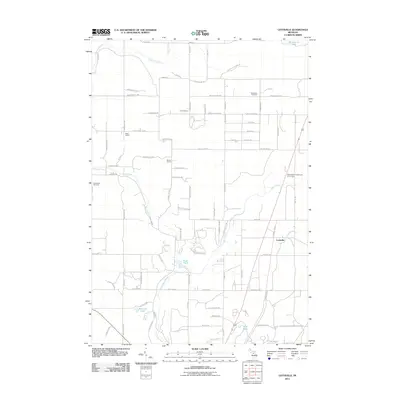
2011 Map of Leetsville
USGS Topo · Published 2011About this map
Rapid River and its tributaries, the Little Rapid River and Spencer Creek, dominate this rural landscape north of Kalkaska during the early 21st century. The settlement of Leetsville stands as a primary point of reference in an area defined by a grid of county roads and historic community markers. Local education history is preserved through the locations of the Lannin School, Miller School, and Barber School, reflecting the distribution of small rural school districts that once served the township.
Find a feature on this map
88 named features on this map. Tap any name to fly to it.
Don’t see what you’re looking for? This feature index may not catch every label — zoom into the map to look around manually.
Map Details
Editions of this 2011 Leetsville Map
This is the sole edition of this map. No revisions or reprints were ever made.
Other maps of this area

1954 · Traverse City
USGS Topo · 1:250,000

1956 · Mancelona
USGS Topo · 1:62,500

1956 · Kalkaska
USGS Topo · 1:62,500

1956 · Fife Lake
USGS Topo · 1:62,500

1957 · Elk Rapids
USGS Topo · 1:62,500

1958 · Traverse City
USGS Topo · 1:250,000

1975 · Mancelona NE
USGS Topo · 1:24,000

1975 · Mancelona NW
USGS Topo · 1:24,000

1983 · Traverse City
USGS Topo · 1:100,000
1983 · Alden
USGS Topo · 1:24,000