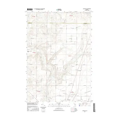
2017 Map of Leetsville
USGS Topo · Published 2017About this map
Kalkaska and Leetsville anchor the landscape of this Northern Michigan interior, where the Rapid River and Little Rapid River carve through the glacial terrain. The area is defined by a dense network of country roads such as Westwood Rd NW and Plum Valley Rd NE, which follow the township and range survey lines of the 19th-century Public Land Survey System. These roads connect localized landmarks like Westwood Cem and Maplegrove Cem, serving as critical reference points for local genealogy and history.
Find a feature on this map
111 named features on this map. Tap any name to fly to it.
Don’t see what you’re looking for? This feature index may not catch every label — zoom into the map to look around manually.
Map Details
Editions of this 2017 Leetsville Map
This is the sole edition of this map. No revisions or reprints were ever made.
Other maps of this area

1954 · Traverse City
USGS Topo · 1:250,000

1956 · Mancelona
USGS Topo · 1:62,500

1956 · Kalkaska
USGS Topo · 1:62,500

1956 · Fife Lake
USGS Topo · 1:62,500

1957 · Elk Rapids
USGS Topo · 1:62,500

1958 · Traverse City
USGS Topo · 1:250,000

1975 · Mancelona NE
USGS Topo · 1:24,000

1975 · Mancelona NW
USGS Topo · 1:24,000

1983 · Traverse City
USGS Topo · 1:100,000
1983 · Alden
USGS Topo · 1:24,000