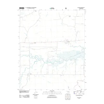
2011 Map of Leflore
USGS Topo · Published 2011About this map
Fourche Maline and the Poteau River dominate the lowlands of this southern LeFlore County region, where intricate marshlands and winding watercourses shape the settlement patterns between the mountain ridges. The community of Leflore serves as a local hub in the south, while Fanshawe and Hughes line the east-west corridor further north. This 2011 survey captures a landscape defined by its hydrography, with Cedar Creek and Coal Creek feeding into the larger river systems. Genealogists will find the Hicks Chapel Cemetery in the northeastern uplands near Norris, providing a vital point of reference for local family histories. The map detail reflects a rural economy connected by an extensive network of county roads, such as Leflore Rd and Bull Hill Rd, which navigate the terrain surrounding Turkey Creek and Peach Creek.
Find a feature on this map
35 named features on this map. Tap any name to fly to it.
Don’t see what you’re looking for? This feature index may not catch every label — zoom into the map to look around manually.
Map Details
Editions of this 2011 Leflore Map
This is the sole edition of this map. No revisions or reprints were ever made.
Other maps of this area

1900 · Sansbois
USGS Topo · 1:125,000

1900 · Sallisaw
USGS Topo · 1:125,000

1900 · Winding Stair
USGS Topo · 1:125,000

1901 · Tuskahoma
USGS Topo · 1:125,000

1908 · Tuskahoma
USGS Topo · 1:125,000

1909 · Tuskahoma
USGS Topo · 1:125,000

1909 · Winding Stair
USGS Topo · 1:125,000

1909 · Sans Bois
USGS Topo · 1:125,000

1911 · Sallisaw
USGS Topo · 1:125,000

1911 · Sansbois
USGS Topo · 1:125,000