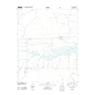
2012 Map of Leflore
USGS Topo · Published 2012About this map
The Fourche Maline river meanders across this landscape, creating a complex wetland corridor that separates the northern settlements from the town of Leflore. This survey of the region captures the area's rural character, where small communities like Fanshawe, Hughes, and Norris are connected by a network of county roads and local streets such as Ruby St and Broadway Ave. To the northeast, the presence of Hicks Chapel Cem near Coal Cr provides a focal point for genealogical interest, marking a traditional center for the surrounding families.
Find a feature on this map
58 named features on this map. Tap any name to fly to it.
Don’t see what you’re looking for? This feature index may not catch every label — zoom into the map to look around manually.
Map Details
Editions of this 2012 Leflore Map
This is the sole edition of this map. No revisions or reprints were ever made.
Other maps of this area

1900 · Sansbois
USGS Topo · 1:125,000

1900 · Sallisaw
USGS Topo · 1:125,000

1900 · Winding Stair
USGS Topo · 1:125,000

1901 · Tuskahoma
USGS Topo · 1:125,000

1908 · Tuskahoma
USGS Topo · 1:125,000

1909 · Tuskahoma
USGS Topo · 1:125,000

1909 · Winding Stair
USGS Topo · 1:125,000

1909 · Sans Bois
USGS Topo · 1:125,000

1911 · Sallisaw
USGS Topo · 1:125,000

1911 · Sansbois
USGS Topo · 1:125,000