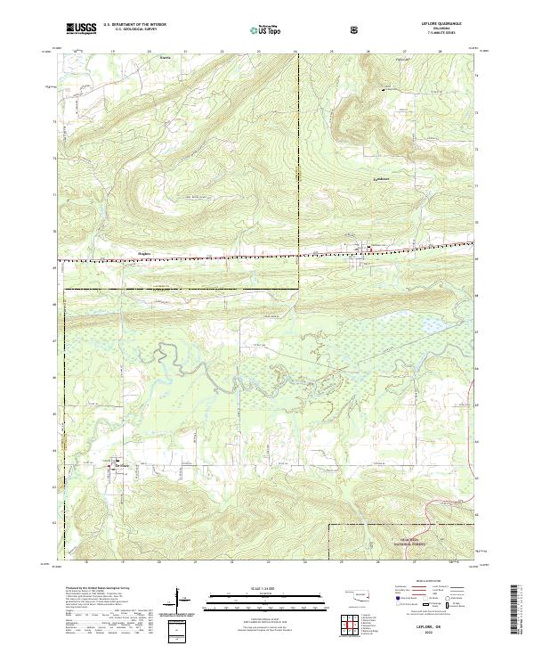
2022 Map of Leflore
USGS Topo · Published 2022About this map
Fourche Maline meanders through the central landscape of this Oklahoma quadrangle, defining a complex drainage pattern that has long influenced settlement along the Latimer and Le Flore county line. The small communities of Le Flore, Fanshawe, Hughes, and Norris are connected by a network of rural routes like Leflore Rd, reflecting the area's agricultural and timber-based economy. To the south, the topography rises significantly as it enters the Ouachita National Forest, while Pigeon Mtn stands as a prominent landmark in the northeast. Genealogists will find several key burial sites documented, including LeFlore Cem, Fanshawe Cem, and Chapel Cem near Hicks. The presence of numerous creeks such as Brazil Cr and Peach Cr highlights the transition from the valley floor to the forested uplands.
Find a feature on this map
68 named features on this map. Tap any name to fly to it.
Don’t see what you’re looking for? This feature index may not catch every label — zoom into the map to look around manually.
Map Details
Editions of this 2022 Leflore Map
This is the sole edition of this map. No revisions or reprints were ever made.
Other maps of this area

1900 · Sansbois
USGS Topo · 1:125,000

1900 · Sallisaw
USGS Topo · 1:125,000

1900 · Winding Stair
USGS Topo · 1:125,000

1901 · Tuskahoma
USGS Topo · 1:125,000

1908 · Tuskahoma
USGS Topo · 1:125,000

1909 · Tuskahoma
USGS Topo · 1:125,000

1909 · Winding Stair
USGS Topo · 1:125,000

1909 · Sans Bois
USGS Topo · 1:125,000

1911 · Sallisaw
USGS Topo · 1:125,000

1911 · Sansbois
USGS Topo · 1:125,000