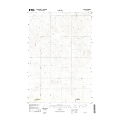
2014 Map of Lefor NW
USGS Topo · Published 2014About this map
The rugged divide between Stark Co and Hettinger Co defines this portion of southwestern North Dakota. In the northwest corner, the terrain is marked by the winding course of Antelope Cr, a primary water source in a landscape otherwise dominated by high plateaus and rolling hills. The map reveals a highly structured section-line road network, where routes like 46th St Sw and 110th Ave Sw create a vast grid across the prairie. This spatial arrangement reflects the enduring legacy of the Homestead Act, illustrating how the rural landscape was partitioned for agricultural use. While few residential structures are named, the intricate contour lines show the complex drainage patterns leading toward the county line near 54th St Sw.
Find a feature on this map
18 named features on this map. Tap any name to fly to it.
Don’t see what you’re looking for? This feature index may not catch every label — zoom into the map to look around manually.
Map Details
Editions of this 2014 Lefor NW Map
This is the sole edition of this map. No revisions or reprints were ever made.
Other maps of this area

1953 · Dickinson
USGS Topo · 1:250,000

1957 · Dickinson
USGS Topo · 1:250,000

1959 · Dickinson South
USGS Topo · 1:24,000

1959 · Lehigh
USGS Topo · 1:24,000

1973 · Lefor NW
USGS Topo · 1:24,000

1973 · Lefor
USGS Topo · 1:24,000

1973 · Gladstone
USGS Topo · 1:24,000

1973 · New England
USGS Topo · 1:24,000

1973 · Lefor SW
USGS Topo · 1:24,000

1973 · Stony Butte
USGS Topo · 1:24,000