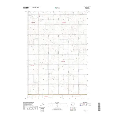
2020 Map of Lefor NW
USGS Topo · Published 2020About this map
Antelope Cr meanders across the northwestern corner of this territory, serving as one of the few prominent natural landmarks in a landscape otherwise defined by a meticulous grid of rural roads. The boundary between Stark Co and Hettinger Co runs along the southern edge of the survey, marked by 54th St Sw. This region represents the agricultural interior of southwestern North Dakota, where the Public Land Survey System has dictated the placement of nearly all transportation infrastructure. The map reveals the precise layout of section lines and range townships, such as t137n r95w, which organize the farmsteads and open plains. Extensive local roads, including 109th Ave Sw and 104 1/4 Ave Sw, illustrate the connectivity maintained between remote sections of the county.
Find a feature on this map
30 named features on this map. Tap any name to fly to it.
Don’t see what you’re looking for? This feature index may not catch every label — zoom into the map to look around manually.
Map Details
Editions of this 2020 Lefor NW Map
This is the sole edition of this map. No revisions or reprints were ever made.
Other maps of this area

1953 · Dickinson
USGS Topo · 1:250,000

1957 · Dickinson
USGS Topo · 1:250,000

1959 · Dickinson South
USGS Topo · 1:24,000

1959 · Lehigh
USGS Topo · 1:24,000

1973 · Lefor NW
USGS Topo · 1:24,000

1973 · Lefor
USGS Topo · 1:24,000

1973 · Gladstone
USGS Topo · 1:24,000

1973 · New England
USGS Topo · 1:24,000

1973 · Lefor SW
USGS Topo · 1:24,000

1973 · Stony Butte
USGS Topo · 1:24,000