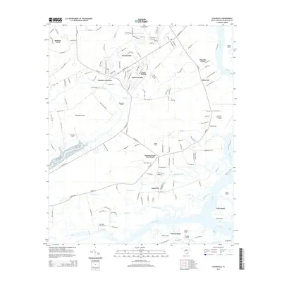
2014 Map of Legareville
USGS Topo · Published 2014About this map
The tidal landscape of the South Carolina Lowcountry is captured here in detail, centered on the complex intersection of islands and waterways south of Charleston. Johns Island dominates the central portion of the sheet, defined by a network of rural roads connecting settlements like Huskum Corner Cross Roads and Fenwick Crossroads. The map documents the persistent settlement patterns of the sea islands, from the inland reaches of Humbert Woods to the historic riverside location of Legareville near the Kiawah River.
Find a feature on this map
155 named features on this map. Tap any name to fly to it.
Don’t see what you’re looking for? This feature index may not catch every label — zoom into the map to look around manually.
Map Details
Editions of this 2014 Legareville Map
This is the sole edition of this map. No revisions or reprints were ever made.
Other maps of this area

1918 · Kiawah Island
USGS Topo · 1:21,120

1919 · Johns Island
USGS Topo · 1:21,120

1919 · Wadmelaw Island
USGS Topo · 1:62,500

1919 · Charleston
USGS Topo · 1:21,120

1919 · James Island
USGS Topo · 1:21,120

1919 · Legareville
USGS Topo · 1:21,120

1920 · Ravenels
USGS Topo · 1:62,500

1943 · Legareville
USGS Topo · 1:24,000

1943 · James Island
USGS Topo · 1:24,000

1943 · Kiawah Island
USGS Topo · 1:24,000