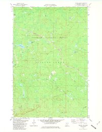
1981 Map of Legler Lake
USGS Topo · Published 1982About this map
Superior National Forest defines this part of Lake County, where industrial activity and wilderness management intersect in the early 1980s. A prominent Mining Railroad cuts across the landscape, marking the region's historical reliance on mineral extraction and the logistical networks required to move resources through the woods. The drainage patterns are defined by the Split Rock River and its western branch, alongside the Gooseberry River and Kit Creek.
Find a feature on this map
18 named features on this map. Tap any name to fly to it.
Don’t see what you’re looking for? This feature index may not catch every label — zoom into the map to look around manually.
Map Details
Editions of this 1981 Legler Lake Map
2 editions found
Other maps of this area

1953 · Whyte
USGS Topo · 1:62,500

1954 · Silver Bay
USGS Topo · 1:62,500

1954 · Two Harbors
USGS Topo · 1:250,000

1956 · Split Rock Point
USGS Topo · 1:24,000

1956 · Split Rock Point
USGS Topo · 1:62,500

1957 · Two Harbors
USGS Topo · 1:250,000

1957 · Two Harbors
USGS Topo · 1:62,500

1957 · Two Harbors NE
USGS Topo · 1:24,000

1958 · Two Harbors
USGS Topo · 1:250,000

1964 · Two Harbors
USGS Topo · 1:250,000