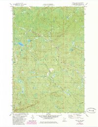
1981 Map of Legler Lake
USGS Topo · Published 1985About this map
Norshor Junction serves as a lone named focal point in this heavily forested landscape within the Superior National Forest. The map illustrates a region defined by industrial transport and seasonal movement, notably the prominent Mining Railroad and an Old Grade that hint at the area's timber or mineral extraction history. Waterways like the Split Rock River and the upper reaches of the Gooseberry River wind through the township of Silver Creek, which is dotted with remote lakes including Langley Lake, Marble Lake, and the functionally named Water Tank Lake. This 1980s-era revision highlights the evolution of land use in the North Woods, showing an established network of recreational paths such as the Snowmobile Trail and Winter Trail alongside active extraction sites like the Gravel Pit near Kit Creek.
Find a feature on this map
20 named features on this map. Tap any name to fly to it.
Don’t see what you’re looking for? This feature index may not catch every label — zoom into the map to look around manually.
Map Details
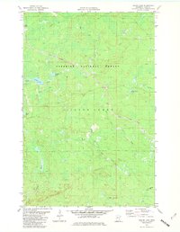
Editions of this 1981 Legler Lake Map
2 editions found
Other maps of this area

1953 · Whyte
USGS Topo · 1:62,500

1954 · Silver Bay
USGS Topo · 1:62,500

1954 · Two Harbors
USGS Topo · 1:250,000

1956 · Split Rock Point
USGS Topo · 1:24,000

1956 · Split Rock Point
USGS Topo · 1:62,500

1957 · Two Harbors
USGS Topo · 1:250,000

1957 · Two Harbors
USGS Topo · 1:62,500

1957 · Two Harbors NE
USGS Topo · 1:24,000

1958 · Two Harbors
USGS Topo · 1:250,000

1964 · Two Harbors
USGS Topo · 1:250,000