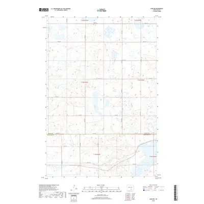
2018 Map of Lehr SW
USGS Topo · Published 2018About this map
The Ebenezer Church and Ebenezer Cem stand near the northern edge of this high plains landscape, serving as a focal point for the rural community straddling the line between Logan and McIntosh Counties. This 2018 survey reveals a terrain defined by glacial prairie potholes and wetlands, with Doyles Lake and Mud Lake marking significant depressions in the landscape. The region is strictly organized by a dense grid of section-line roads, including 72nd St SE and 80th St SE, which facilitate access across the vast agricultural township divisions of T134N R70W down to T132N R69W. The pattern of small, scattered wetlands suggests a complex drainage system typical of the Missouri Coteau, where the infrastructure is built around the natural hydrology of the North Dakota prairie.
Find a feature on this map
21 named features on this map. Tap any name to fly to it.
Don’t see what you’re looking for? This feature index may not catch every label — zoom into the map to look around manually.
Map Details
Editions of this 2018 Lehr SW Map
This is the sole edition of this map. No revisions or reprints were ever made.
Other maps of this area

1953 · Jamestown
USGS Topo · 1:250,000

1956 · Jamestown
USGS Topo · 1:250,000

1982 · Danzig
USGS Topo · 1:24,000

1982 · Wishek NE
USGS Topo · 1:24,000

1982 · May Lake
USGS Topo · 1:24,000

1982 · Lehr NW
USGS Topo · 1:24,000

1982 · Lehr NE
USGS Topo · 1:24,000

1982 · Ashley NE
USGS Topo · 1:24,000

1982 · Lehr SW
USGS Topo · 1:24,000

1982 · Wishek
USGS Topo · 1:24,000