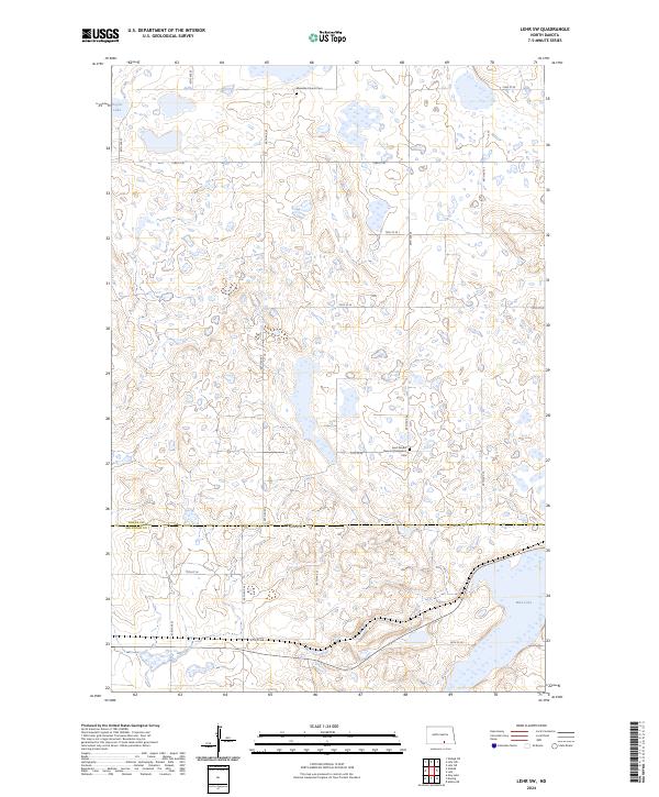
2024 Map of Lehr SW
USGS Topo · Published 2024About this map
Logan County Waterfowl Production Area dominates much of this landscape, reflecting a region defined by its conservation lands and wetland ecology. The terrain is dotted with small prairie potholes and water bodies such as Doyles Lake and Mud Lake, illustrating the distinctive glacial topography of the North Dakota plains. Cultural landmarks provide a glimpse into the area's heritage, notably at Saint Jacobs German Evangelical Cem and the nearby Ebenezer Church, which sits alongside the Ebenezer Church Cem. These sites, along with the Mcintosh County Waterfowl Production Area straddling the southern border, highlight a sparsely populated rural district where agricultural section lines like 78th St SE separate vast tracts of protected wildlife habitat from local farmstead developments.
Find a feature on this map
23 named features on this map. Tap any name to fly to it.
Don’t see what you’re looking for? This feature index may not catch every label — zoom into the map to look around manually.
Map Details
Editions of this 2024 Lehr SW Map
This is the sole edition of this map. No revisions or reprints were ever made.
Other maps of this area

1953 · Jamestown
USGS Topo · 1:250,000

1956 · Jamestown
USGS Topo · 1:250,000

1982 · Danzig
USGS Topo · 1:24,000

1982 · Wishek NE
USGS Topo · 1:24,000

1982 · May Lake
USGS Topo · 1:24,000

1982 · Lehr NW
USGS Topo · 1:24,000

1982 · Lehr NE
USGS Topo · 1:24,000

1982 · Ashley NE
USGS Topo · 1:24,000

1982 · Lehr SW
USGS Topo · 1:24,000

1982 · Wishek
USGS Topo · 1:24,000