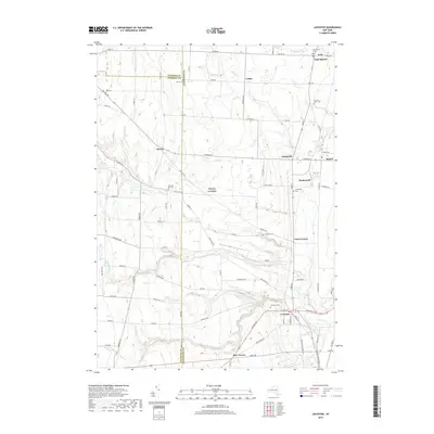
2019 Map of Leicester
USGS Topo · Published 2019About this map
Leicester and the surrounding Genesee Valley uplands are defined by a network of rural hamlets and agricultural crossroads at the time of this 2019 survey. The landscape is characterized by its rolling topography and numerous drainage systems, including Beards Cr and Little Beards Cr, which have shaped the settlement patterns of Livingston and Wyoming Counties. Smaller communities such as Peoria, Greigsville, and Wadsworth appear alongside specialized locales like Retsof, reflecting the area's long-standing reliance on salt mining and farming.
Find a feature on this map
86 named features on this map. Tap any name to fly to it.
Don’t see what you’re looking for? This feature index may not catch every label — zoom into the map to look around manually.
Map Details
Editions of this 2019 Leicester Map
This is the sole edition of this map. No revisions or reprints were ever made.
Other maps of this area

1904 · Batavia
USGS Topo · 1:62,500

1904 · Caledonia
USGS Topo · 1:62,500

1905 · Portage
USGS Topo · 1:62,500

1905 · Nunda
USGS Topo · 1:62,500

1943 · Mount Morris
USGS Topo · 1:24,000

1943 · Sonyea
USGS Topo · 1:24,000

1943 · Castile
USGS Topo · 1:24,000
1944 · Sonyea
USGS Topo · 1:31,680
1944 · Geneseo
USGS Topo · 1:31,680
1944 · Mount Morris
USGS Topo · 1:31,680