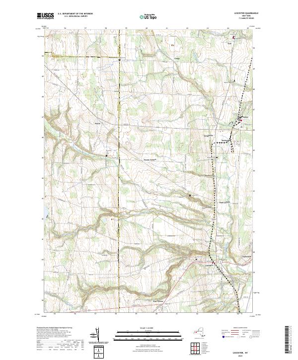
2023 Map of Leicester
USGS Topo · Published 2023About this map
Leicester serves as a focal point in this Western New York landscape, situated at the junction of several local routes south of Little Beards Creek. The surrounding area is defined by a dense network of hamlets and rural crossroads including Cuylerville, Greigsville, and Wadsworth. The terrain is deeply carved by drainage systems like Spezzano Gully and Taunton Gully, which feed into Beards Creek as it flows toward the eastern boundary. This survey highlights the region's long-established settlement patterns, evidenced by numerous family and community burial grounds such as Old Scotch Cem, Mountain Ash Cem, and Olivet Cem. The conversion of rail infrastructure is noted by the Groveland Secondary Trailway Trl, which cuts through the northeastern corner near Retsof. These details offer a clear view of the area's transition from a rail-dependent agricultural and mining corridor to its modern rural character.
Find a feature on this map
93 named features on this map. Tap any name to fly to it.
Don’t see what you’re looking for? This feature index may not catch every label — zoom into the map to look around manually.
Map Details
Editions of this 2023 Leicester Map
This is the sole edition of this map. No revisions or reprints were ever made.
Other maps of this area

1904 · Batavia
USGS Topo · 1:62,500

1904 · Caledonia
USGS Topo · 1:62,500

1905 · Portage
USGS Topo · 1:62,500

1905 · Nunda
USGS Topo · 1:62,500

1943 · Mount Morris
USGS Topo · 1:24,000

1943 · Sonyea
USGS Topo · 1:24,000

1943 · Castile
USGS Topo · 1:24,000
1944 · Sonyea
USGS Topo · 1:31,680
1944 · Geneseo
USGS Topo · 1:31,680
1944 · Mount Morris
USGS Topo · 1:31,680