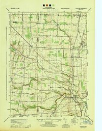
1944 Map of Leicester
USGS Topo · Published 1944About this map
Delaware Lackawanna and Western Railroad tracks and the Genesee and Wyoming Railroad dominate the landscape of the Genesee Valley during the mid-1940s. The map illustrates a dense network of industrial and agricultural transportation through Leicester, York, and Retsof, where the infrastructure of the salt mining region is clearly defined. Rural life is anchored by small landmarks such as School No 7 and the Olivet Cem, while the winding course of Beards Creek cuts through the western terrain near Cloverdale. The intersection of multiple rail systems, including the Pennsylvania Railroad and the Hudson System, highlights the area's importance as a transit corridor for New York’s southern tier and Genesee Valley products just before the post-war era transformed regional logistics.
Find a feature on this map
36 named features on this map. Tap any name to fly to it.
Don’t see what you’re looking for? This feature index may not catch every label — zoom into the map to look around manually.
Map Details
Editions of this 1944 Leicester Map
This is the sole edition of this map. No revisions or reprints were ever made.
Other maps of this area

1904 · Batavia
USGS Topo · 1:62,500

1904 · Caledonia
USGS Topo · 1:62,500

1905 · Portage
USGS Topo · 1:62,500

1905 · Nunda
USGS Topo · 1:62,500

1943 · Mount Morris
USGS Topo · 1:24,000

1943 · Sonyea
USGS Topo · 1:24,000

1943 · Castile
USGS Topo · 1:24,000
1944 · Sonyea
USGS Topo · 1:31,680
1944 · Geneseo
USGS Topo · 1:31,680
1944 · Mount Morris
USGS Topo · 1:31,680