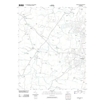
2010 Map of Leipers Fork
USGS Topo · Published 2010About this map
Franklin and its western rural surroundings are defined by the winding course of the Harpeth River and a dense network of family cemeteries and historical landmarks. The landscape shifts from the town's residential expansion near Winstead Hill and Reid Hill to the rolling hollows and ridges of the Tennessee countryside. Of particular significance to local historians and genealogists are the numerous burial sites, including multiple instances of a Slave Cemetery and family plots like the McGavock Cemetery and Stone Cemetery.
Find a feature on this map
130 named features on this map. Tap any name to fly to it.
Don’t see what you’re looking for? This feature index may not catch every label — zoom into the map to look around manually.
Map Details
Editions of this 2010 Leipers Fork Map
This is the sole edition of this map. No revisions or reprints were ever made.
Other maps of this area

1901 · Colombia
USGS Topo · 1:125,000

1903 · Nashville
USGS Topo · 1:125,000

1909 · Franklin
USGS Topo · 1:62,500

1930 · White Bluff
USGS Topo · 1:62,500

1932 · Nashville
USGS Topo · 1:62,500

1933 · White Bluff
USGS Topo · 1:62,500

1936 · Spring Hill
USGS Topo · 1:24,000

1936 · Theta
USGS Topo · 1:24,000

1936 · Bethesda
USGS Topo · 1:24,000

1946 · Leipers Fork
USGS Topo · 1:24,000