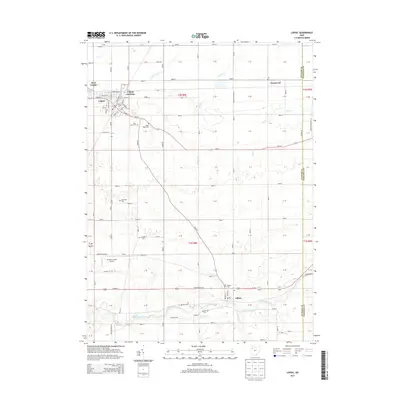
2013 Map of Leipsic
USGS Topo · Published 2013About this map
Leipsic and its neighboring villages of West Leipsic and Gilboa define the settlement patterns of this agricultural region in Putnam County. The landscape is oriented around a dense network of township roads and several significant waterways, including the Blanchard River and Yellow Cr. For family historians, the area is notably rich in burial grounds, featuring many smaller, named plots such as Sugar Ridge Cem, Maidlow Cem, and the pointedly named Cholera Cem near Gilboa.
Find a feature on this map
121 named features on this map. Tap any name to fly to it.
Don’t see what you’re looking for? This feature index may not catch every label — zoom into the map to look around manually.
Map Details
Editions of this 2013 Leipsic Map
This is the sole edition of this map. No revisions or reprints were ever made.
Other maps of this area

1906 · Columbus Grove
USGS Topo · 1:62,500

1907 · Bluffton
USGS Topo · 1:62,500

1908 · Columbus Grove
USGS Topo · 1:62,500

1908 · Ottawa
USGS Topo · 1:62,500

1950 · Marion
USGS Topo · 1:250,000

1953 · Fort Wayne
USGS Topo · 1:250,000

1953 · Muncie
USGS Topo · 1:250,000

1956 · Muncie
USGS Topo · 1:250,000

1956 · Fort Wayne
USGS Topo · 1:250,000

1956 · Toledo
USGS Topo · 1:250,000