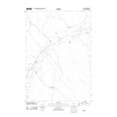
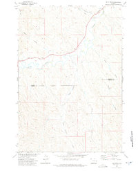
2012 Map of Leiter
USGS Topo · Published 2012About this map
Leiter serves as the focal point of this Sheridan County landscape, situated along the winding course of Clear Cr. This early 21st-century survey illustrates an environment defined by water management and ranching infrastructure, most notably through the extensive irrigation network including Pratt and Ferris Ditch Number 2 and Pratt and Ferris Ditch Number 3. These ditches cut across the varied terrain, which is deeply etched by numerous seasonal watercourses. Notable topographic features carry descriptive names such as Dead Mans Draw, Black Stump Draw, and Big Corral Draw, the latter leading toward the Big Corral landmark. To the east, the Cadiz Reservoir provides a significant water storage point near Cadiz Draw, reflecting the essential relationship between the local geography and the arid requirements of Wyoming high-plains agriculture and livestock operations.
Find a feature on this map
20 named features on this map. Tap any name to fly to it.
Don’t see what you’re looking for? This feature index may not catch every label — zoom into the map to look around manually.
Map Details
Editions of this 2012 Leiter Map
This is the sole edition of this map. No revisions or reprints were ever made.
Other maps of this area

1955 · Sheridan
USGS Topo · 1:250,000

1958 · Sheridan
USGS Topo · 1:250,000

1962 · Sheridan
USGS Topo · 1:250,000
1971 · Shuler Draw
USGS Topo · 1:24,000
1971 · Clearmont
USGS Topo · 1:24,000

1971 · Arvada
USGS Topo · 1:24,000

1971 · Gardner Gulch
USGS Topo · 1:24,000
1971 · Fawn Draw
USGS Topo · 1:24,000

1971 · Leiter
USGS Topo · 1:24,000
1971 · Julio Draw
USGS Topo · 1:24,000