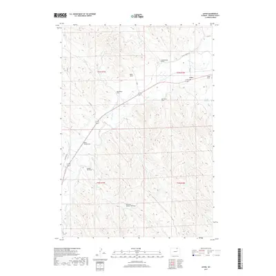
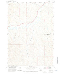
2017 Map of Leiter
USGS Topo · Published 2017About this map
Leiter sits at a geographic crossroads in Sheridan County, where the high plains are deeply etched by a network of seasonal draws and irrigation infrastructure. The landscape is defined by the critical movement of water through the Pratt and Ferris Ditch Number 3 and Pratt and Ferris Ditch Number 2, which divert flow from Clear Creek to support agricultural life in this arid region. The settlement pattern follows these watercourses and the established paths of the Black & Yellow Trl, a route that connects the small community to the wider ranching territory. Names like Dead Mans Draw, Big Corral Draw, and Black Stump Draw reflect a local history rooted in livestock management and the early challenges of the Wyoming frontier. This survey highlights the spatial relationship between natural drainage and man-made systems like the Cadiz Reservoir.
Find a feature on this map
25 named features on this map. Tap any name to fly to it.
Don’t see what you’re looking for? This feature index may not catch every label — zoom into the map to look around manually.
Map Details
Editions of this 2017 Leiter Map
This is the sole edition of this map. No revisions or reprints were ever made.
Other maps of this area

1955 · Sheridan
USGS Topo · 1:250,000

1958 · Sheridan
USGS Topo · 1:250,000

1962 · Sheridan
USGS Topo · 1:250,000
1971 · Shuler Draw
USGS Topo · 1:24,000
1971 · Clearmont
USGS Topo · 1:24,000

1971 · Arvada
USGS Topo · 1:24,000

1971 · Gardner Gulch
USGS Topo · 1:24,000
1971 · Fawn Draw
USGS Topo · 1:24,000

1971 · Leiter
USGS Topo · 1:24,000
1971 · Julio Draw
USGS Topo · 1:24,000