
1971 Map of Leiter
USGS Topo · Published 1975About this map
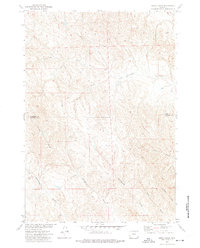
Clear Creek meanders through the heart of this Sheridan County landscape, serving as the primary hydrological feature in an area defined by deep drainage patterns and agricultural water management. The small settlement of Leiter sits along the Burlington Northern railroad line, which follows the creek valley, while Big Corral marks a distinct point downstream. The complex irrigation network of the Pratt and Ferris Ditch No 3 and Pratt and Ferris Ditch No 2 illustrates the efforts of early ranching and farming interests to divert water across the dry benches. The topography is heavily dissected by numerous named draws, such as Cottonwood Draw, Dead Mans Draw, and Miller Draw, creating a rugged series of ridges and valleys that transition toward the East Fork. A solitary Pumping Sta and scattered wells indicate the infrastructure required to support life and industry in this northern Wyoming terrain.
Find a feature on this map
20 named features on this map. Tap any name to fly to it.
Don’t see what you’re looking for? This feature index may not catch every label — zoom into the map to look around manually.
Map Details
Editions of this 1971 Leiter Map
This is the sole edition of this map. No revisions or reprints were ever made.
Other maps of this area

1955 · Sheridan
USGS Topo · 1:250,000

1958 · Sheridan
USGS Topo · 1:250,000

1962 · Sheridan
USGS Topo · 1:250,000
1971 · Shuler Draw
USGS Topo · 1:24,000
1971 · Clearmont
USGS Topo · 1:24,000

1971 · Arvada
USGS Topo · 1:24,000

1971 · Gardner Gulch
USGS Topo · 1:24,000
1971 · Fawn Draw
USGS Topo · 1:24,000
1971 · Julio Draw
USGS Topo · 1:24,000
1972 · Jewell Draw
USGS Topo · 1:24,000