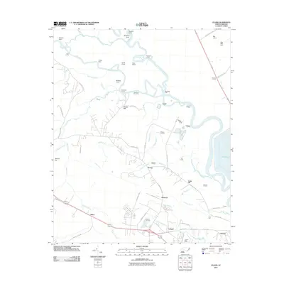
2011 Map of Leland
USGS Topo · Published 2011About this map
The Cope Fear River and its intricate network of tributaries, including Indian Creek and Mulberry Branch, define the low-lying landscape of this coastal North Carolina region. This 2011 survey illustrates the development of Leland and its surrounding communities such as Phoenix, Eastbrook, and the industrial rail hub at Navassa. The area is marked by a deep connection to its waterways, as evidenced by numerous landings like Peachtree Landing and Hale Point Landing, as well as the significant infrastructure of Davis Yard and Richards Crossing. Genealogists will find notable value in the mapping of local family and community burial grounds, including Williams Cemetery, Mulberry Cemetery, and Cedar Hill Cemetery. North of the town centers, the map shows Lake Sutton and the wilder terrain of Roan Island and Bill Neal Island, where the river splits into various cuts and branches.
Find a feature on this map
76 named features on this map. Tap any name to fly to it.
Don’t see what you’re looking for? This feature index may not catch every label — zoom into the map to look around manually.
Map Details
Editions of this 2011 Leland Map
This is the sole edition of this map. No revisions or reprints were ever made.
Other maps of this area

1942 · Wilmington
USGS Topo · 1:62,500

1943 · Winnabow
USGS Topo · 1:24,000

1943 · Lewis Swamp
USGS Topo · 1:24,000

1944 · Winnabow
USGS Topo · 1:31,680

1944 · Lewis Swamp
USGS Topo · 1:31,680

1947 · Rocky Point
USGS Topo · 1:62,500

1948 · Wilmington
USGS Topo · 1:62,500

1950 · Winnabow
USGS Topo · 1:25,000

1953 · Florence
USGS Topo · 1:250,000

1953 · Beaufort
USGS Topo · 1:250,000