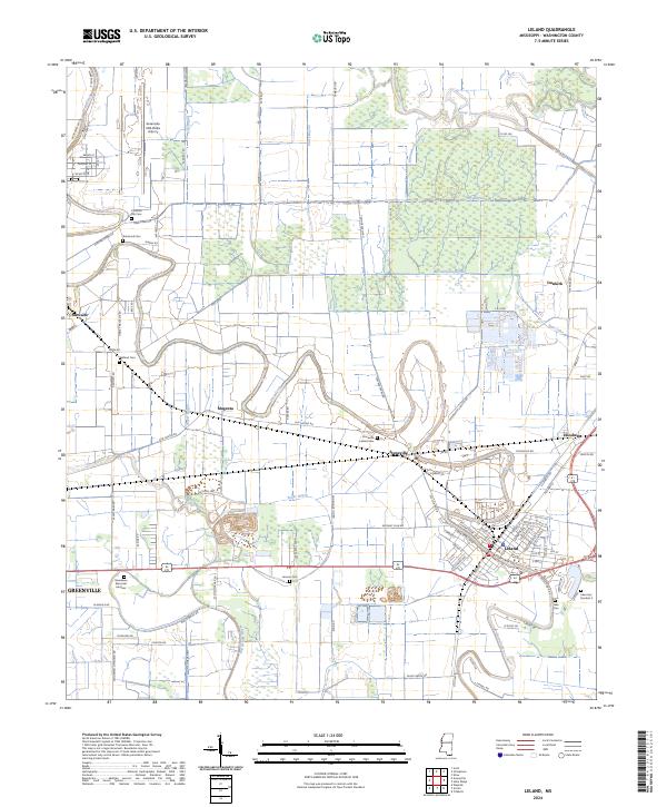
2024 Map of Leland
USGS Topo · Published 2024About this map
The winding waters of Deer Creek and McCutcheon Bayou define the agricultural landscape of Washington County in this recent 2024 survey. The area is anchored by the community of Leland, where numerous local streets and landmarks are documented alongside the adjacent research hub of Stoneville. The landscape shows a deep history of land management through its dense network of bayous, including Roper Bayou, Dry Bayou, and Red Bridge Bayou, which carve through the fertile Delta soil.
Find a feature on this map
93 named features on this map. Tap any name to fly to it.
Don’t see what you’re looking for? This feature index may not catch every label — zoom into the map to look around manually.
Map Details
Editions of this 2024 Leland Map
This is the sole edition of this map. No revisions or reprints were ever made.
Other maps of this area

1933 · Lamont
USGS Topo · 1:62,500

1939 · Refuge
USGS Topo · 1:62,500

1939 · Lamont
USGS Topo · 1:62,500

1939 · Tralake
USGS Topo · 1:62,500

1939 · Choctaw
USGS Topo · 1:62,500

1953 · Greenwood
USGS Topo · 1:250,000

1956 · Greenwood
USGS Topo · 1:250,000
1967 · Tribbett
USGS Topo · 1:24,000

1967 · Arcola
USGS Topo · 1:24,000

1967 · Stringtown
USGS Topo · 1:24,000