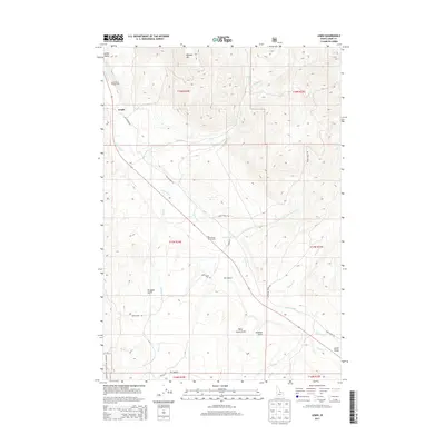
2013 Map of Lemhi
USGS Topo · Published 2013About this map
Lemhi and the surrounding Lemhi Valley define this section of the high mountain corridor, where the Lemhi River serves as the primary geographic axis. The landscape is characterized by a network of drainage systems like Yearian Cr and Zeph Cr that flow from the steep elevations of Ramsey Mtn toward the valley floor. Transportation patterns are clearly visible through the alignment of Old Highway 28 and the more modern routing, while secondary routes like Lemhi Back Rd and Maiers Ln provide access to the dispersed valley homesteads.
Find a feature on this map
32 named features on this map. Tap any name to fly to it.
Don’t see what you’re looking for? This feature index may not catch every label — zoom into the map to look around manually.
Map Details
Editions of this 2013 Lemhi Map
This is the sole edition of this map. No revisions or reprints were ever made.
Other maps of this area

1955 · Dubois
USGS Topo · 1:250,000

1956 · Leadore
USGS Topo · 1:62,500

1956 · Patterson
USGS Topo · 1:62,500

1956 · Lemhi
USGS Topo · 1:62,500

1958 · Dubois
USGS Topo · 1:250,000

1965 · Lemhi Pass
USGS Topo · 1:24,000
1965 · Goat Mountain
USGS Topo · 1:24,000

1980 · Leadore
USGS Topo · 1:100,000
1987 · West of Leadore
USGS Topo · 1:24,000
1989 · Lemhi
USGS Topo · 1:24,000