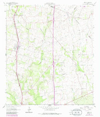
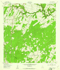
1964 Map of Leming
USGS Topo · Published 1986About this map
Leming serves as a central hub in this Atascosa County landscape, where the Missouri Pacific railroad corridor cuts a straight line through the South Texas brush country. The map reveals a dispersed settlement pattern characterized by numerous family and community burial grounds, including the Tumlinson Cem and Rodriguez Cem, which point to a deep-rooted history of rural land ownership and kinship. Small clusters like Las Gallinas and Loire dot the periphery, often centered around landmarks like St Joseph Ch.
Find a feature on this map
26 named features on this map. Tap any name to fly to it.
Don’t see what you’re looking for? This feature index may not catch every label — zoom into the map to look around manually.
Map Details
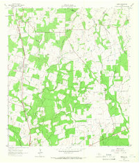
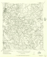
Editions of this 1964 Leming Map
2 editions found
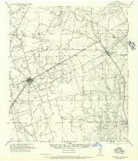
Other maps of this area

1953 · Crystal City
USGS Topo · 1:250,000

1954 · San Antonio
USGS Topo · 1:250,000

1955 · Crystal City
USGS Topo · 1:250,000
1956 · Pleasanton
USGS Topo · 1:62,500
1956 · Jourdanton
USGS Topo · 1:62,500

1957 · San Antonio
USGS Topo · 1:250,000
1958 · Losoya
USGS Topo · 1:24,000
1958 · Thelma
USGS Topo · 1:24,000
1958 · Saspamco
USGS Topo · 1:24,000

1961 · Crystal City
USGS Topo · 1:250,000