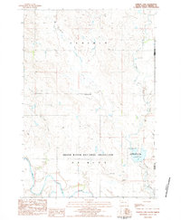
1983 Map of Lemmon Lake
USGS Topo · Published 1984About this map
Grand River National Grassland dominates the southern half of this landscape, reflecting a conservation-focused era of land management in Perkins County. The terrain is defined by a dense network of drainages, including Thunder Hawk Creek and East Thunder Hawk Creek, which carve through the plains toward the south. Near the center of the survey, Dog Tooth Creek winds through open country before meeting the Grand River corridor. Cultural features are sparse, consisting primarily of scattered wells and occasional gravel pits, indicating an economy centered on ranching and natural resource extraction rather than dense settlement. The eastern boundary is marked by Lemmon Lake State Game Production Area, where Lemmon Lake serves as a primary water feature and recreational anchor for the surrounding Dewitt and Lincoln townships.
Find a feature on this map
14 named features on this map. Tap any name to fly to it.
Don’t see what you’re looking for? This feature index may not catch every label — zoom into the map to look around manually.
Map Details
Editions of this 1983 Lemmon Lake Map
This is the sole edition of this map. No revisions or reprints were ever made.
Other maps of this area

1953 · McIntosh
USGS Topo · 1:250,000

1954 · Lemmon
USGS Topo · 1:250,000

1957 · Lemmon
USGS Topo · 1:250,000

1958 · McIntosh
USGS Topo · 1:250,000

1972 · Black Horse Butte NW
USGS Topo · 1:24,000

1972 · Thunder Hawk SW
USGS Topo · 1:24,000
1972 · Thunder Hawk
USGS Topo · 1:24,000

1974 · Lemmon
USGS Topo · 1:24,000
1974 · Lemmon NE
USGS Topo · 1:24,000

1980 · McIntosh
USGS Topo · 1:100,000