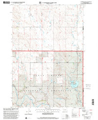
1998 Map of Lemmon Lake
USGS Topo · Published 2001About this map
Cedar River National Grassland dominates this South Dakota landscape, where the open plains are defined by the winding course of the Grand River and the waters of Lemmon Lake. The map reveals a dispersed settlement pattern characteristic of the High Plains, anchored by family-named ranching operations such as the B Penfield Ranch, C Penfield Ranch, and L Miller Ranch. Educational history is noted at the Dewitt School, while the presence of numerous Windmills across the terrain highlights the necessity of water management for livestock in this semi-arid environment.
Find a feature on this map
17 named features on this map. Tap any name to fly to it.
Don’t see what you’re looking for? This feature index may not catch every label — zoom into the map to look around manually.
Map Details
Editions of this 1998 Lemmon Lake Map
This is the sole edition of this map. No revisions or reprints were ever made.
Other maps of this area

1953 · McIntosh
USGS Topo · 1:250,000

1954 · Lemmon
USGS Topo · 1:250,000

1957 · Lemmon
USGS Topo · 1:250,000

1958 · McIntosh
USGS Topo · 1:250,000

1972 · Black Horse Butte NW
USGS Topo · 1:24,000

1972 · Thunder Hawk SW
USGS Topo · 1:24,000
1972 · Thunder Hawk
USGS Topo · 1:24,000

1974 · Lemmon
USGS Topo · 1:24,000
1974 · Lemmon NE
USGS Topo · 1:24,000

1980 · McIntosh
USGS Topo · 1:100,000