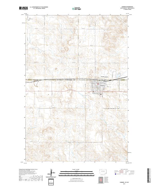
2021 Map of Lemmon
USGS Topo · Published 2021About this map
The borderlands of the Dakotas are anchored by the city of Lemmon, a community positioned directly against the state line separating Perkins County and Adams County. The street grid of the main settlement south of the line is detailed with thoroughfares such as 1st St W and Dakota St, while its northern counterpart, North Lemmon, sits just across the boundary. The surrounding landscape is defined by the drainage of Thunder Hawk Cr and E Flat Cr, which cut through a high-plains terrain marked by rural landmarks like Greenhill Cem and North Lemmon Cem. A network of section-line roads, including Watman Rd and Watros Rd, illustrates the persistent rectangular survey system that has governed land ownership and travel in this region since the homesteading era.
Find a feature on this map
51 named features on this map. Tap any name to fly to it.
Don’t see what you’re looking for? This feature index may not catch every label — zoom into the map to look around manually.
Map Details
Editions of this 2021 Lemmon Map
This is the sole edition of this map. No revisions or reprints were ever made.
Other maps of this area

1953 · Dickinson
USGS Topo · 1:250,000

1954 · Lemmon
USGS Topo · 1:250,000

1957 · Dickinson
USGS Topo · 1:250,000

1957 · Lemmon
USGS Topo · 1:250,000
1974 · Nason Hill
USGS Topo · 1:24,000

1974 · Cedar Butte
USGS Topo · 1:24,000

1974 · White Butte
USGS Topo · 1:24,000

1974 · Lemmon
USGS Topo · 1:24,000
1974 · Lemmon NE
USGS Topo · 1:24,000

1980 · Mott
USGS Topo · 1:100,000