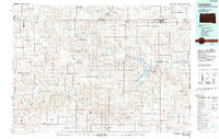
1984 Map of Lemmon
USGS Topo · Published 1988About this map
The Grand River National Grassland dominates this mid-1980s landscape, sprawling across the border of North Dakota and South Dakota. The topography is defined by the drainage of the Grand River and its South Fork, converging at the significant Shadehill Reservoir. This man-made water body serves as a focal point for the region, supported by the Shadehill Reservoir State Recreation Area and the Llewellyn Johns Memorial State Recreation Area.
Find a feature on this map
81 named features on this map. Tap any name to fly to it.
Don’t see what you’re looking for? This feature index may not catch every label — zoom into the map to look around manually.
Map Details
Editions of this 1984 Lemmon Map
2 editions found
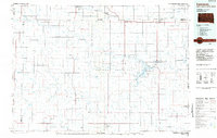
Other maps of this area

1935 · Reva
USGS Topo · 1:125,000

1935 · Hoover
USGS Topo · 1:125,000

1953 · McIntosh
USGS Topo · 1:250,000

1953 · Dickinson
USGS Topo · 1:250,000

1954 · Lemmon
USGS Topo · 1:250,000

1954 · Bismarck
USGS Topo · 1:250,000

1957 · Dickinson
USGS Topo · 1:250,000

1957 · Lemmon
USGS Topo · 1:250,000

1958 · Bismarck
USGS Topo · 1:250,000

1958 · McIntosh
USGS Topo · 1:250,000