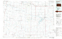
1984 Map of Lemmon
USGS Topo · Published 1984About this map
The Grand River National Grassland dominates this mid-1980s landscape, spanning the border between North Dakota and South Dakota. The northern edge follows the Burlington Northern railroad corridor, connecting regional hubs like Lemmon and Hettinger. Water management is central to the area's geography, anchored by the Shadehill Reservoir and its associated Shadehill State Recreation Area, alongside numerous smaller water features such as Lodgepole Dam and Cole Dam. The terrain is characterized by prominent high points like White Butte and Grandma Butte that break the prairie horizons. Small settlements and crossroads such as Lodgepole, Strool, and Meadow Corner serve as the primary human touchpoints in this cattle and grasslands region, while the Lemmon Municipal Airport and Bison Municipal Airport provide vital transportation links to this corner of the High Plains.
Find a feature on this map
56 named features on this map. Tap any name to fly to it.
Don’t see what you’re looking for? This feature index may not catch every label — zoom into the map to look around manually.
Map Details
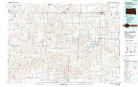
Editions of this 1984 Lemmon Map
2 editions found
Other maps of this area

1935 · Reva
USGS Topo · 1:125,000

1935 · Hoover
USGS Topo · 1:125,000

1953 · McIntosh
USGS Topo · 1:250,000

1953 · Dickinson
USGS Topo · 1:250,000

1954 · Lemmon
USGS Topo · 1:250,000

1954 · Bismarck
USGS Topo · 1:250,000

1957 · Dickinson
USGS Topo · 1:250,000

1957 · Lemmon
USGS Topo · 1:250,000

1958 · Bismarck
USGS Topo · 1:250,000

1958 · McIntosh
USGS Topo · 1:250,000