
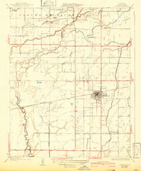
1927 Map of Lemoore
USGS Topo · Published 1927About this map
Laguna De Tache defines the northern landscape of this Kings County region, where the complex hydrology of the Kings River meets an expanding network of early 20th-century irrigation. The map reveals the critical importance of water management to the San Joaquin Valley's agricultural development, shown through named infrastructure like the Lemoore Canal and Lower Kings River Ditch. The town of Lemoore serves as the central hub, situated along the Southern Pacific railroad line which also connects the smaller loading points of Heinlen and Rossi. Evidence of rural community life is preserved in the location of the Island School and Island Church near the river forks, while the Mussel Slough School stands further south, marking the social centers of this farming landscape in the mid-1920s.
Find a feature on this map
22 named features on this map. Tap any name to fly to it.
Don’t see what you’re looking for? This feature index may not catch every label — zoom into the map to look around manually.
Map Details
Editions of this 1927 Lemoore Map
2 editions found
Other maps of this area

1924 · Riverdale
USGS Topo · 1:31,680

1926 · Hanford
USGS Topo · 1:31,680

1926 · Lethent
USGS Topo · 1:31,680

1927 · Laton
USGS Topo · 1:31,680

1927 · Burrel
USGS Topo · 1:31,680

1927 · Riverdale
USGS Topo · 1:31,680

1929 · Guernsey
USGS Topo · 1:31,680

1929 · Stratford
USGS Topo · 1:31,680

1929 · Westhaven
USGS Topo · 1:31,680
1940 · Stratford
USGS Topo · 1:62,500